Chennai

Located 10 km north of Chennai, Nazarathpettai is a village known for its rich history. It is the birthplace of the former Chief Minister of the Madras Presidency and leader of the Indian National Congress, Minjur Bhaktavatsalam. Moreover, the village also shares a rich history of its Shiva Temple, which dates back 1000 years.
Nazarathpettai is a growing residential area in Chennai, offering apartments, plots, and houses suitable for mid-income buyers. It has good road connectivity through Trunk Road, Poonamallee Bypass Road, and the Chennai Outer Ring Road. The area is close to several IT companies, providing employment opportunities, and is about 11 km from Ambattur Industrial Estate.
Nearby educational institutions include Alpha College of Engineering and RISHS International School, among others. Healthcare is accessible with hospitals like Panimalar Medical College Hospital within a 6-10 km range. Local supermarkets meet daily needs, and public transport is facilitated by MTC buses.
While the area does face some connectivity challenges, such as poor road conditions and limited street lighting, there is reason for optimism. Ongoing development projects, including the metro rail work and improved infrastructure, are set to transform Nazarathpettai into a well-connected and desirable place to live in Chennai.
What’s Good | What Can Be Better |
Excellent connectivity through major roads like Trunk Road and Chennai Outer Ring Road | Limited bus services from Poonamallee to Tiruvallur during peak hours |
Strategic location near IT/ITes hubs, providing ample employment opportunities | Poor road conditions in Poonamallee leading to traffic delays |
Reliable MTC bus network facilitating seamless citywide travel | Insufficient street lighting poses safety risks during night-time travel |
Close proximity to reputed educational institutions and well-equipped healthcare facilities | Inadequate stormwater drainage, causing flooding during heavy rains |
Upcoming metro rail project set to enhance overall connectivity | Air pollution remains a concern due to suboptimal Air Quality Index levels |
Nazarathpettai offers strong road connectivity through key routes like Trunk Road, Poonamallee Bypass Road, and the Chennai Outer Ring Road, ensuring easy access to various parts of Chennai and nearby industrial areas. Public transport is reliable, with MTC buses providing convenient citywide travel, and the proximity to Chennai International Airport further enhances its connectivity. The ongoing Chennai Metro Rail project is expected to boost transportation options significantly. While the area features essential amenities such as reputable educational institutions and healthcare facilities, challenges like inadequate street lighting, poor road conditions in some parts, and issues with stormwater drainage during the monsoon season slightly impact the livability. However, continued infrastructure development is expected to improve these aspects, enhancing the overall livability.
There are several restaurants in Nazarathpettai because it is located near the Bengaluru-Chennai Highway. Some of them are mentioned below:
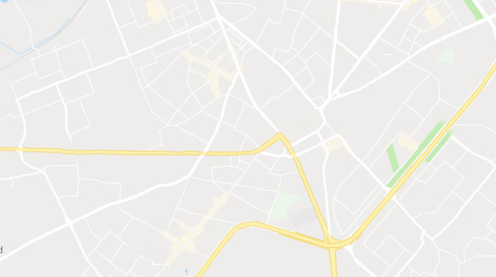
Nazarathpettai is one of the oldest villages in Chennai and is rich in history. Its accessibility to major highways makes it one of the most convenient localities. Below is the map showing the routes and infrastructure of the locality.
Nazarathpettai has good connectivity to major highways and roads. Some of them are mentioned below:
This road is a significant corridor in Chennai, primarily serving as a bypass for traffic around the Poonamallee area, reducing congestion within the town. It connects major highways and is integral to Chennai's transport infrastructure. It also plays a role in the Chennai Metro network with a proposed metro station at Poonamallee Bypass.
Officially known as State Highway 234 (SH 234), the Chennai Outer Ring Road is a crucial 62 km long transport corridor encircling the Chennai Metropolitan Area. It connects multiple national highways, including GST Road, NH 48, NH 716, and NH 16, facilitating traffic flow around the city and reducing congestion within urban areas.
This under-construction expressway, designated as National Expressway 7 (NE-7), will span 258 km between Bangalore and Chennai. It is a four-lane, access-controlled road designed to significantly reduce travel time between the two cities. The expressway is expected to be completed by 2025 and is poised to boost connectivity and economic development along the route.
Nearby Locality | Distance (km) |
Nazarathpettai to distance Agaramel | 1.2 km |
Nazarathpettai to distance Poonamalle | 2.6 km |
Nazarathpettai to distance Thirumazhisai | 2.5 km |
Nazarathpettai to distance Chembarakkam | 7.1 km |
Nazarathpettai to distance Meppur Village | 2.7 km |
Residents generally rate Nazarathpettai positively, with ratings often reflecting satisfaction with its growing infrastructure and proximity to major IT hubs. The area receives good scores for connectivity, thanks to its well-linked road network and public transport options. However, concerns about traffic congestion, particularly during peak hours, and occasional flooding issues slightly lower the ratings. Overall, the locality is viewed as developing and holds promise for the future, especially with ongoing infrastructure projects that are expected to improve livability further.
Nazarathpettai, located in the western part of Chennai, is accessible through various modes of transportation. Whether you’re travelling by road, air, or rail, reaching Nazarathpettai is convenient and straightforward.
Nazarathpettai is well-connected via several major roads, including the Poonamallee Bypass Road, Trunk Road, and Chennai Outer Ring Road. You can reach the area by car or using Chennai’s extensive MTC bus network, which offers direct routes from various parts of the city. The roads are well-maintained, making road travel comfortable and efficient.
The nearest airport to Nazarathpettai is Chennai International Airport, located about 20 km away. After landing, you can hire a taxi or use a ride-sharing service to reach Nazarathpettai via Mount-Poonamallee Road. The drive typically takes around 30-45 minutes, depending on traffic conditions, making it a convenient option for travellers coming from other cities or countries.
The closest major railway station is Chennai Central, situated approximately 25 km from Nazarathpettai. From Chennai Central, you can take a taxi, an auto-rickshaw, or catch a bus to Nazarathpettai. Additionally, Poonamallee Railway Station is nearby, offering a more localised rail connection. Rail travel is a practical option for those travelling from other parts of Tamil Nadu or neighbouring states.
Place to Visit | Description |
Vaitheeswaran Koil Temple | Vaitheeswaran Koil, also known as the Temple of Healing, is a prominent Hindu temple in Tamil Nadu dedicated to Lord Shiva, worshipped here as Vaidyanathar, the "God of Healing." The temple is part of the Navagraha (nine planets) temples and is associated with the planet Mars (Angaraka). It is believed that prayers and rituals performed here can cure diseases. The temple's holy tank, Siddhamirtham, is thought to have healing properties. The temple is also famous for its connection to Nadi astrology. |
Queens Land Amusement Park | Queens Land is a popular amusement park located in Poonamallee, Chennai, spanning 70 acres. It opened in August 2003 and offers a variety of rides, including 33 for adults and 18 for children. Some of its notable attractions include the Free Fall Tower and several water rides. The park is easily accessible via the Chennai-Bangalore Trunk Road and is a favourite destination for families and youth looking for a fun day out. |
Chembarambakkam Lake | Chembarambakkam Lake is a prominent lake located near Chennai, Tamil Nadu, about 40 km from the city. It is one of the key water reservoirs that supply drinking water to the city of Chennai. The lake has a significant capacity, holding up to 3,645 million cubic feet of water. It also serves as the starting point for the Adyar River, which flows through Chennai. Historically, the lake was known as Puliyur Kottam and was a vital part of the region during the Chola period. |
Nazarathpettai stands out for its excellent road connectivity, including the Trunk Road and Poonamallee Bypass, and its proximity to IT hubs and industrial areas, making it ideal for mid-income residential options. Unlike Agaramel and Meppur Village, which are quieter and more rural, Nazarathpettai offers better access to amenities like schools, hospitals, and supermarkets. While Poonamallee is more established with a wider range of services, Nazarathpettai benefits from ongoing metro projects, promising further development. Compared to Chembarakkam and Thirumazhisai, Nazarathpettai is more balanced in terms of infrastructure, connectivity, and residential growth.
Nazarathpettai offers strong road connectivity, particularly through the Trunk Road and Poonamallee Bypass, and is conveniently located near IT hubs and industrial areas. It is an emerging residential locality with mid-income housing options and access to essential amenities such as schools, hospitals, and supermarkets. The ongoing metro rail project is expected to further enhance its connectivity and development. Nazarathpettai's balanced infrastructure and proximity to employment centres make it a promising area for residential growth in Chennai.
The best schools in Nazarathpettai include Alpha College of Engineering, RISHS International School, Sri Venkateswara Matriculation Higher Secondary School, and Panimalar Engineering College.
The nearest railway station to Nazarathpettai is Pattabiram Railway Station.
Banks available in the locality include City Union Bank, Indian Overseas Bank, Shinhan Bank, and ATMs from Axis Bank, Bank of Baroda, and HDFC Bank.
The distance between Nazarathpettai and the Vaitheeswaran Temple is approximately 2.6 kilometres.
Some of the popular restaurants in the locality are Viruthunagar Chettinad Hotel, Hotel Jaihind Dhaba, Dindigul Thalappakatti Restaurant, Madurai Sri Pandiyan Hotel, and Anjappar Chettinad Restaurant.
| Schools Near by Nazarathpettai | |
|---|---|
| Jaya Jaya Sankara International School | 0.18 KM |
| Msjm Hindhu Vidhyalaya Higher Secondary Scho | 0.98 KM |
| Round Table 30 Vivekananda Vidyalaya | 1.16 KM |
| Holy Cresent Mat. Hr. Sec. School | 1.92 KM |
| Spartan International School | 2.14 KM |
| Sri Saradha Bala Vidyalaya | 2.15 KM |
| Spartan International School | 2.21 KM |
| Sri Arabhindho Matric Hr Sec School | 2.30 KM |
| Saint Paul's Matriculation School | 2.30 KM |
| Sri Sathya Matriculation Higher Secondary School | 2.34 KM |
| Bus Stops Near by Nazarathpettai | |
|---|---|
| Rice Mill | 0.44 KM |
| Post Office | 0.44 KM |
| Nazarathpet Police Check Post | 0.57 KM |
| Poonamallee | 0.62 KM |
| Agaram Mel | 0.63 KM |
| Nazareth Pettai | 0.71 KM |
| Nazarathpet | 0.76 KM |
| Thirumazhisai Koot Road | 1.01 KM |
| Panimalar Bus Depot | 1.03 KM |
| Nazarathpettai | 1.15 KM |
| Hospitals Near by Nazarathpettai | |
|---|---|
| Sri Jayendra Saraswathi Ayurveda College & Hospital | 0.26 KM |
| Hope Hospital And Pharmacy 24*7 | 1.41 KM |
| Panimalar Medical College Hospital & Research Institute | 1.50 KM |
| Ramdas Hospital | 1.88 KM |
| Mangalam Hospital | Multi-speciality Hospital In Poonamallee | Chennai | 2.39 KM |
| Be Well Hospitals Poonamallee | 2.66 KM |
| Government Hospital | 2.74 KM |
| Dps Hospital | 2.74 KM |
| Vasanthi Hospital | 3.81 KM |
| Deen Hospital | 3.94 KM |
| Clinics Near by Nazarathpettai | |
|---|---|
| Shade Dentistry | 0.39 KM |
| Happy Smile Dental Care | 0.43 KM |
| Panimalar Medical College | 1.38 KM |
| Panimalar Medical College Entrance | 1.68 KM |
| Premier Health Center | 1.88 KM |
| Tanik Dental Care | 1.93 KM |
| Hitech Diagnostic Centre | 1.95 KM |
| Aarthi Scans & Labs | Thirumazhisai | Diagnostic Center | 2.07 KM |
| Sri Dhanvantri Physiotherapy Clinic (sdpc) | 2.10 KM |
| Dr J Arul Clinic | 2.13 KM |
| Gym Fitness Near by Nazarathpettai | |
|---|---|
| Rp Fitness Center | 1.55 KM |
| Dragon Gym | 1.78 KM |
| Heartfulness Sub Centre | 1.86 KM |
| Dark Warriors Unisex Gym - A/c | 1.92 KM |
| Vp Fitness Lounge | 1.99 KM |
| Yuva Fit & Physique Unisex Fitnesqs Studio Branch 2 | 2.09 KM |
| Power Zone | 2.09 KM |
| King & Queen Fitness Center | 2.27 KM |
| Fitness Square Gym | 2.29 KM |
| Re Gym | 2.33 KM |
| Temples Near by Nazarathpettai | |
|---|---|
| Adhiparasakthi Temple Nazarathpettai | 0.24 KM |
| Kasi Viswanathar Temple | 0.66 KM |
| Sri Ramar Temple | 1.39 KM |
| Vinayagar Temple | 1.47 KM |
| Varageaswari Temple | 1.52 KM |
| Varadharaja Perumal Temple | 1.57 KM |
| Arulmigu Shri Jagannatha Swamy Temple | 1.81 KM |
| Sri Navapasana Raja Murugan Temple | 1.84 KM |
| Sri Othandeeswarar Temple | 1.93 KM |
| Sivam Temple - Arulmigu Kulirndha Nayagi Udanurai Otthaandavar Kovil | 1.93 KM |
| College and Universities Near by Nazarathpettai | |
|---|---|
| Panimalar Engineering College | 0.63 KM |
| Panimalar Institute Of Technology (pit) | 1.06 KM |
| Panimalar College Of Nursing | 1.29 KM |
| Alpha College Of Engineering | 1.46 KM |
| Sree Sastha Institute Of Engineering And Technology | 2.41 KM |
| Sree Sastha Pharmacy College | 2.47 KM |
| A.m.k. Technological Polytechnic College | 2.58 KM |
| Jaya College Of Engineering And Technology | 2.70 KM |
| Nmv University | 3.24 KM |
| Rajalakshmi Institute Of Technology | 3.28 KM |
| Supermarkets Near by Nazarathpettai | |
|---|---|
| Vidhu Supermarket | 0.41 KM |
| Udhayam Super Market | 1.77 KM |
| Sri Akshaya Super Market | 1.85 KM |
| Reliance Market | 1.88 KM |
| Smart Point | 1.88 KM |
| Super Market | 1.98 KM |
| Grace Super Market | 2.28 KM |
| Haneefa Super Market | 2.41 KM |
| Selvam Super Market | 2.77 KM |
| Ready Basket Supermarket | 3.03 KM |
| Churchs Near by Nazarathpettai | |
|---|---|
| Maranatha Church | 1.15 KM |
| E.c.i St. Peter's Church Pidarithangal | 3.06 KM |
| C.s.i. Wesley Church | 3.18 KM |
| Csi Immanuel Church | 3.37 KM |
| C.s.i. St.mary Magdalene Church | 3.53 KM |
| St. John The Baptist Church | 3.95 KM |
| Aca Church Vellavedu | 4.79 KM |
| St. Joseph's Church | 4.82 KM |
| Christ The King Syro Malabar Church | 4.86 KM |
| The Pentecostal Mission (tpm Church)233x+mhf | 5.04 KM |
| Clothings Near by Nazarathpettai | |
|---|---|
| Kancheepuram Varamahalakshmi Silks - Poonamallee | 1.99 KM |
| Ramraj Cotton - Poonamallee | 2.64 KM |
| Superlyfe Poonamallee | 2.78 KM |
| Peter England Menswear Exclusive Showroom | 4.27 KM |
| Louis Philippe Factory Outlet | 4.81 KM |
| Peter England Outlet | 5.09 KM |
| Allen Solly Outlet | 5.17 KM |
| Trends Woman | 6.10 KM |
| Max Fashion | 6.20 KM |
| Reliance Mall | 6.36 KM |