
NH 66 is an astonishing inclusion to the National Highways Authority of India (NHAI), which starts from Maharashtra and ends in Tamil Nadu; by integration, its covers 1,640 km, which is equivalent to 1,020 miles. Moreover, it will showcase some magnificent scenes of the country.
Let’s glimpse at the national highway and its resources like NH 66 new alignment map, tectonic boundaries, and surroundings.
Table of contents
- National Highway 66 (NH 66)
- National Highway 66 Latest Map and Route
- NH 66 Exit and Entry Points
- States Under NH 66
- Famous Places Around National Highway 66
- Speed Limit at National Highway 66
- Toll Rates on NH 66
- Things to Consider While Travelling on National Highway 66
- National Highway 66: Recent Updates
- Frequently Asked Questions (FAQs)
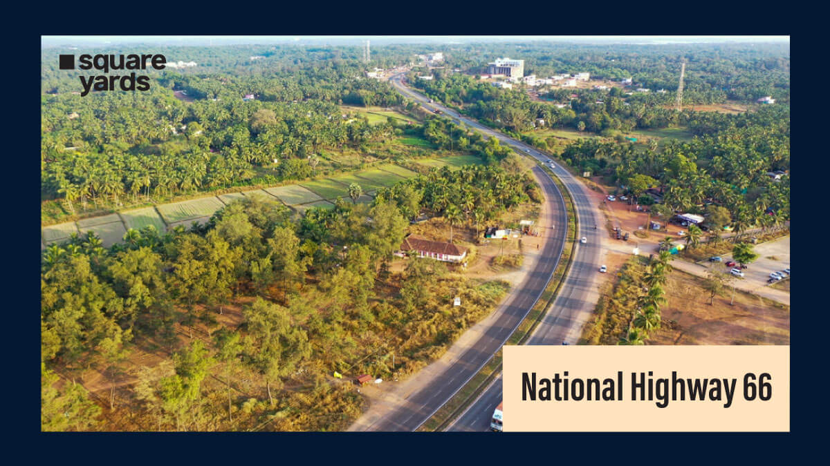
National Highway 66 (NH 66)
National highways are the pillar of the road system, connecting all of the country’s main cities, ports, and states. These highways are built and sustained by the government. The establishment of national highways consists of ample ordinances such as measurements of length, width, interlinked boarding, speed limit, and emergency facilities.
Earlier, NH 66 highway was known as NH 17. National Highway 66 (NH 66) consists of four and six lanes with a great and fatiguing highway stretched out of 1,640 km, which route from north to south; western ghats of India, namely Panvel in Maharashtra to Kanyakumari in Tamil Nadu. The four lanes are being stretched from the borders of Goa to Kerala. Furthermore, six lanes extended from Kottankulangara to Kadambattukonam, Kollam city.
National Highway 66 Latest Map and Route
The NH 66 Map and the route include the following states and their cities:
| Maharashtra | Panvel, Pen, Mangaon, Mahad, Poladpur, Khed, Chiplun, Sangameshwar, Ratnagiri, Lanja, Rajapur, Kankavli, Kudal, Sawantwadi |
| Goa | Panaji, Canacona, Margao |
| Karnataka | Karwar, Ankola, Kumta, Honnavar, Bhatkal, Kundapura, Udupi, Kapu, Mulki, Mangaluru, Kotekar |
| Kerala | Kannur, Kozhikode, Kochi, Haripad, Kayamkulam, Karunagappally, Chavara, Neendakara, Kollam, Kottiyam, Chathannoor, Kallambalam, Attingal, Kazhakkoottam, Thiruvananthapuram, Balaramapuram, Neyyattinkara, Parassala |
| Tamil Nadu | Marthandam, Nagercoil and Kanyakumari |
NH 66 Exit and Entry Points
While travelling via these five states, the highway linked various cities and towns.NH 66 starts from Panvel in Maharashtra and ends at Kanyakumari in Tamil Nadu.
States Under NH 66
When a national highway stretches over 1 640 km in length, it will inevitably connect several states. Similarly, NH 66 spans four Indian states. Let’s look at these states as follows:
● Maharashtra: Maharashtra is a magnificent display of India’s richness. The state welcomes visitors from all over the nation with its numerous tunnels, seaside, famous monuments, innumerable gemstone mountain peaks and a plethora of vibrant sanctuaries. Maharashtra has famous caverns and pilgrimage sites such as Ajanta and Ellora.
● Goa: Goa state lies on India’s southwestern coast, topographically divided by the western ghats from Deccan lane. Due to its solitaire beauty, innumerable tourist visits popular places such as shoreline, vibrant nightlife, religious sites, restaurants, and UNESCO-listed architecture every year. Moreover, it features a diverse flora – fauna due to its proximity to north-western ghats.
● Karnataka: It lies in India’s southwest and is an underappreciated tourist hotspot. When it comes to India’s variety, it is endowed with architectural wonders and a well-endowed legacy. It offers various attractive spots such as beachfront and compelling historical treasures to a diverse multitude of external delights and cuisine to enchant visitors of all types.
● Kerala: Another jewel in the crown, Kerala. It is one of the utmost tourist attractions because of its magnificent hilly sceneries, splendid coastlines, and religious places. Therefore, this state has proved its beauty by enlightening its traditional culture like Kummattikali, a popular vividly mask dance. Generally, it is presented while participating in the Onam festival.
Moreover, NH 66 is widening in Kerala with 91.77 per cent of land acquisitions.
● Tamil Nadu: NH 66 Tamil Nadu; is the end state linked to NH. In comparison to the other states, it runs for a long distance. NH 66 nevertheless offers a lot of terrain for riders who appreciate the environment and vegetation, even though it covers 56 kilometers.
Famous Places Around National Highway 66
Some of the major attractions between National Highway 66 include:
● Karnala Fort and Karnala Bird Sanctuary, Mumbai
● Panhalakaji Caves, Maharashtra
● Alibaug, Maharashtra
● Raigad Fort, Maharashtra
● Sawatsada Waterfalls, Maharashtra
● Anjuna Beach, Goa
● Dudhsagar Waterfalls, Goa
● Fort Aguada, Goa
● Maravanthe beach, Karnataka
● Munnar, Kerala
● Bekal Fort, Kerala
● Muzhappilangad Beach, Kerala
● Silent Valley, Kerala
● Periyar National Park, Kerala-TamilNadu border
● Ooty, Tamil Nadu
● Madurai, Tamil Nadu
● Hogenakkal Falls, Tamil Nadu
Speed Limit at National Highway 66
The speed limit on NH 66 depends on the type of vehicle you are travelling. Generally, NH 66 speed limit is set at 120 km per hour for the expressways, 100 km per hour for the national highways, and 70 km per hour for the state roads.
Toll Rates on NH 66
Toll rates depend from state to state. The NH 66 Kerala authorities have updated rates for the toll, and these toll rates are valid up to
31-March -2023.
The following toll rates for several vehicle types are :
| Vehicle type | Single Journey Charge | Return Journey Charge | Monthly pass Charge | Registered commercial Vehicles charge enclosed plaza |
| Car/Jeep/Van | 45.00 INR | 65.00 INR | 1430.00 INR | 20.00 INR |
| LCV | 70.00 INR | 105.00 INR | 2305.00 INR | 35.00 INR |
| Bus/Truck | 145.00 INR | 220.00 INR | 4835.00 INR | 75.00 INR |
| Up to three Axle vehicles | 160.00 INR | 2350.00 INR | 5275.00 INR | 80.00 INR |
| Four to six Axle vehicles | 225.00 INR | 340.00 INR | 7580.00 INR | 115.00 INR |
| HCM/EME | 225.00 INR | 340.00 INR | 7580.00 INR | 115.00 INR |
| Seven or more Axle | 275.00 INR | 415.00 INR | 9230.00 INR | 140.00 INR |
Things to Consider While Travelling on National Highway 66
Some of the major factors that should be considered while travelling via National Highway 66 are as follows:
● Speed: When it concerns highway driving, amongst the most ignored variable is speed. NH 66 road conditions make it easy to achieve fast speeds because of the lanes, which are bigger and well lighted. Since there are signs saying an 80kph – 120 kph maximum speed limit, get them as a guideline and stick loyal to it. However, they are largely in place to ensure your security and the well-being of those on the road and constantly make an effort to follow guidelines.
● Shifting of lanes: It is considered one of the major aspects while driving. In anticipation, acknowledge the speed limit while shifting from one lane to another by using mirrors and maintaining the relevant distance. Further, the factor is considered important on highways for most vehicles going at high speeds to avoid consequences; always remembering the right-side lane is meant for overtaking. This lane is commonly known as the fast lane, where vehicles can run at 90 kph – 120 kph.
● Spotlight: While driving on the national highway, it is mandatory to keep an eye on the other vehicles’ speed while stopping at a particular place and also turn on the pitfall before halting and starting the pace. The halting of the vehicles can be due to major factors, for instance, shifting of lanes, diversion, and construction of the roads or ancients but do not forget to give a signal while rejoining the national highway after a halt.
● Driving at night: Avoid driving at night, if possible, but when you still have to, drive safely. However, a person can wear special night driving glasses and maintain proper care of the windshield and lights. Additionally, while overtaking, try to avoid the use of high beam light or when closer to the vehicle fore. Furthermore, most vital is to watch the heavy vehicles in the dark as they may consist of heavy loads and are prone to harm other vehicles.
National Highway 66: Recent Updates
Recently, P.A. Mohamed Riyas, Minister for Public Works, addressed the NH 66 issues to the assembly, stating NH 66 would be completed by 2025. As of now, 98.51% of the highway construction has been completed. According to the previous concession agreement, the service road for Thalappadi-Chengala has been agreed to stretch 6.5 to 7 metres wide, along with one fly-over and nine vehicle underpasses. Still, all these requirements have not been fulfilled. In addition, commuters face various problems, such as taxi drivers from Chombal and Azhiyur villages claiming a lack of an appropriate road network at the previously agreed locations. Now, they are forced to travel numerous kilometres to reach the national highway. Moreover, some residents believe that the construction of a toll booth on the Mukkali-Kunhippally stretch is the reason they are facing issues. Furthermore, he requested the government to address the highway construction issues soon.
You May Also Like
Frequently Asked Questions (FAQs)
What is the new name of NH-66?
The Six lane highway is the new name of NH- 66.
What is the total length of NH-66?
The total length of NH-66 is 1,640 km.
Which is the smallest national highway in Kerala?
National highway 966B is the smallest national highway in Kerala at 8km in length. It starts from Kundannoor in Kochi (Kerala) and terminates at Willingdon Island in Kochi(Kerala).
